
Transforming Industries with Real-time Visual Data Intelligence
Get In Touch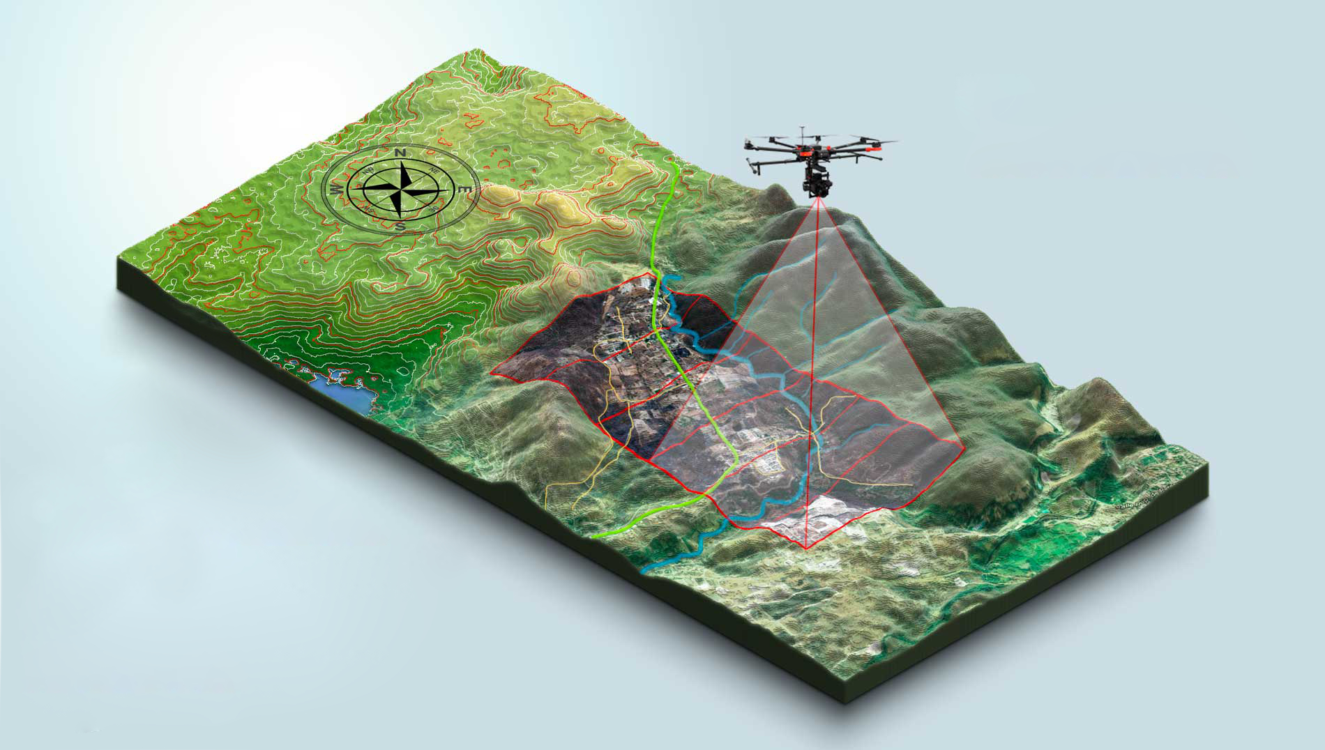
Every day, thousands of professionals rely on TERRA WATCH (TW) to get instant and accurate insights from their survey data that allow them to make smarter, faster, and more collaborative business decisions.
Our services is currently being used by power generation & distribution, agriculture, security and construction industries to have an updated, highly accurate view of their projects.
 Why Terra Watch
TERRA WATCH (TW) is the go-to solution for professionals across various industries, revolutionizing the way they derive valuable insights from their survey data. With our cutting-edge technology, users gain instant and accurate information that empowers them to make smarter, faster, and more collaborative business decisions.
 How It works
leveraging advanced technology to transform survey data into instant, accurate insights, empowering professionals to make smarter, data-driven decisions with ease.
 Benefits
providing industries with cost-effective, high-resolution aerial data for enhanced decision-making, increased efficiency, and improved safety. Harnessing the power of drones, businesses gain a competitive edge by accessing comprehensive visual information and accelerating project timelines
A fully integrated suite of software services