
In-depth guide to drone multispectral imagery. Find out how it benefits precision agriculture, land management, forestry, and environmental monitoring, and how drones, including the multispectral, capable drones can increase the efficiency and accuracy of multispectral data collection.
Multispectral imaging captures and records light across a range of wavelengths within the electromagnetic spectrum - including those outside of the visible spectrum, such as infrared and ultra-violet.
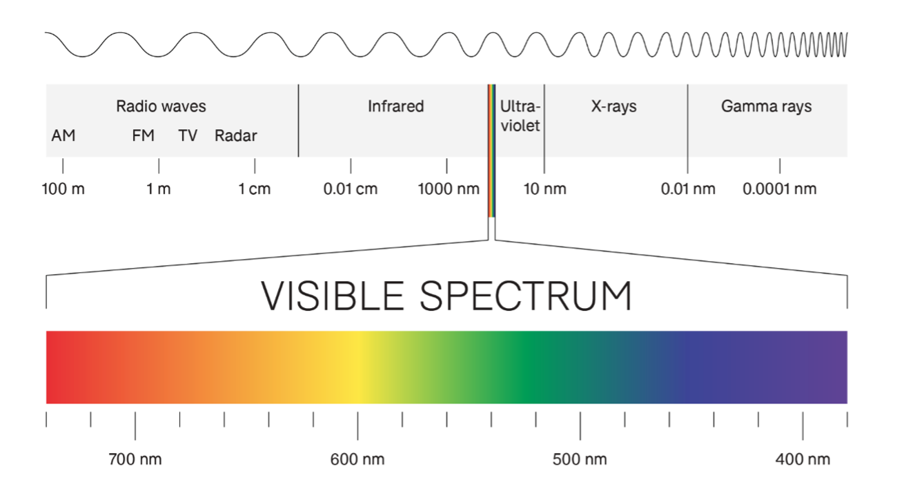
As a result, multispectral imaging provides the ability to extract additional information which the human eye or standard industrial vision cameras fail to capture.
And this extra information has tremendous value to those in agriculture, forestry, and land management.
In turn, this data enables farmers to detect issues early and make informed and more targeted management decisions that can improve crop yields, save resources, and reduce waste and costs.
In forestry, multispectral imagery can be used to identify and map various features of the forest, such as tree species, tree health, and biomass. It can also be used to detect and monitor changes in the forest over time, such as the spread of disease or the impact of logging. Additionally, multispectral imagery can be used to estimate the volume of timber in a forest, which is important for sustainable forestry management.